Stadt Dortmund: WMS - DSW Haltestelle
Informationen zu Haltestellen der DSW in Dortmund
Simple
Identification info
- Date (Revision)
- 2018-08-17T11:49:58
- Status
- On going
Telephone number of a facsimile machine for the responsible organization or individual
http://geo.dortmund.de
-
Anwendungen
-
-
map.apps
-
-
theme.govdata
-
-
Bevölkerung
-
Infrastruktur, Bauen und Wohnen
-
Transport und Verkehr
-
- Use limitation
-
Datenlizenz Deutschland – Namensnennung – Version 2.0
- Use constraints
- License
- Other constraints
-
Stadt Dortmund
- Service Type
- OGC:WMS
- Service Version
-
1.3.0
- Fees
-
keine Kosten
))
Coupled Resource
- Operation Name
-
GetMap
- Identifier
-
8ba96fc0db38b71bbd4ced401dfd2aa6ccc95979
Coupled Resource
- Operation Name
-
GetMap
- Identifier
-
43c217ae2d9c41576c8f81282a9b0e5955e6b96f
- Coupling Type
- Tight
Contains Operations
- Operation Name
-
GetCapabilities
- Distributed Computing Platforms
- HTTP-GET
- Connect Point
-
Format : text/xml
(
text/xml
)
Format :
text/xml
Contains Operations
- Operation Name
-
GetMap
- Distributed Computing Platforms
- HTTP-GET
- Connect Point
-
Format : image/jpeg
(
image/jpeg
)
Format :
image/jpeg
- Connect Point
-
Format : image/png
(
image/png
)
Format :
image/png
- Connect Point
-
Format : image/png; mode=16bit
(
image/png; mode=16bit
)
Format :
image/png; mode=16bit
- Connect Point
-
Format : image/png; mode=8bit
(
image/png; mode=8bit
)
Format :
image/png; mode=8bit
- Connect Point
-
Format : image/png; mode=1bit
(
image/png; mode=1bit
)
Format :
image/png; mode=1bit
- Connect Point
-
Format : application/dxf
(
application/dxf
)
Format :
application/dxf
Contains Operations
- Operation Name
-
GetFeatureInfo
- Distributed Computing Platforms
- HTTP-GET
- Connect Point
-
Format : text/plain
(
text/plain
)
Format :
text/plain
- Connect Point
-
Format : text/html
(
text/html
)
Format :
text/html
- Connect Point
-
Format : text/xml
(
text/xml
)
Format :
text/xml
- Connect Point
-
Format : application/vnd.ogc.gml
(
application/vnd.ogc.gml
)
Format :
application/vnd.ogc.gml
- Connect Point
-
Format : application/vnd.ogc.gml/3.1.1
(
application/vnd.ogc.gml/3.1.1
)
Format :
application/vnd.ogc.gml/3.1.1
Contains Operations
- Operation Name
-
sld:GetLegendGraphic
- Distributed Computing Platforms
- HTTP-GET
- Connect Point
-
Format : image/jpeg
(
image/jpeg
)
Format :
image/jpeg
- Connect Point
-
Format : image/png
(
image/png
)
Format :
image/png
Contains Operations
- Operation Name
-
sld:DescribeLayer
- Distributed Computing Platforms
- HTTP-GET
- Connect Point
-
Format : text/xml
(
text/xml
)
Format :
text/xml
Contains Operations
- Operation Name
-
qgs:GetStyles
- Distributed Computing Platforms
- HTTP-GET
- Connect Point
-
Format : text/xml
(
text/xml
)
Format :
text/xml
- Distribution format
-
-
WMS
(
1.3.0
)
-
WMS
(
1.3.0
)
- OnLine resource
-
DSWHaltestelle
(
OGC:WMS-http-get-map
)
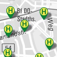
Haltestelle_Bus
- Hierarchy level
- Service
Attributes
- Statement
-
Erfassung durch DSW
- File identifier
- 2b76576c436fc6f4c004540f2cc437440485ad7c XML
- Metadata language
- Deutsch
- Character set
- UTF8
- Hierarchy level
- Service
- Hierarchy level name
-
WMS-Dienst
- Date stamp
- 2018-08-17T12:09:01
- Metadata standard name
-
ISO 19119/2005
- Metadata standard version
-
1.0
Overviews
Spatial extent
Provided by