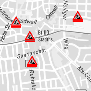
Stadt Dortmund: WMS - Baustellen
WMS-Dienst mit den Straßenbaustellen in der Stadt Dortmund
Simple
Identification info
- Date (Revision)
- 2017-09-01T08:21:22
- Status
- On going
Telephone number of a facsimile machine for the responsible organization or individual
https://geoweb1.digistadtdo.de/doris_gdi/
- Theme
-
-
Doris
-
Verkehr
-
Dortmund
-
Baustellen
-
UMN MapServer
-
Straße
-
Tiefbauamt
-
-
Anwendungen
-
-
map.apps
-
-
theme.govdata
-
-
Transport und Verkehr
-
- Access constraints
- License
- Other constraints
-
Datenlizenz Deutschland – Namensnennung – Version 2.0
- Service Type
- OGC:WMS
- Service Version
-
1.3.0
- Fees
-
keine
))
Coupled Resource
- Operation Name
-
GetMap
- Identifier
-
03ab812988c0636d26595ca736cfd2cbe955b49b
Coupled Resource
- Operation Name
-
GetMap
- Identifier
-
631f9ec8e129bf58a64d7241cbc63e326819ce2b
- Coupling Type
- Tight
Contains Operations
- Operation Name
-
GetCapabilities
- Distributed Computing Platforms
- HTTP-GET
- Distributed Computing Platforms
- HTTP-POST
- Connect Point
-
Format : text/xml
(
text/xml
)
Format :
text/xml
Contains Operations
- Operation Name
-
GetMap
- Distributed Computing Platforms
- HTTP-GET
- Distributed Computing Platforms
- HTTP-POST
- Connect Point
-
Format : image/jpeg
(
image/jpeg
)
Format :
image/jpeg
- Connect Point
-
Format : image/png
(
image/png
)
Format :
image/png
- Connect Point
-
Format : image/gif
(
image/gif
)
Format :
image/gif
- Connect Point
-
Format : image/png; mode=8bit
(
image/png; mode=8bit
)
Format :
image/png; mode=8bit
- Connect Point
-
Format : application/x-pdf
(
application/x-pdf
)
Format :
application/x-pdf
- Connect Point
-
Format : image/svg+xml
(
image/svg+xml
)
Format :
image/svg+xml
- Connect Point
-
Format : image/tiff
(
image/tiff
)
Format :
image/tiff
- Connect Point
-
Format : application/vnd.google-earth.kml+xml
(
application/vnd.google-earth.kml+xml
)
Format :
application/vnd.google-earth.kml+xml
- Connect Point
-
Format : application/vnd.google-earth.kmz
(
application/vnd.google-earth.kmz
)
Format :
application/vnd.google-earth.kmz
Contains Operations
- Operation Name
-
GetFeatureInfo
- Distributed Computing Platforms
- HTTP-GET
- Distributed Computing Platforms
- HTTP-POST
- Connect Point
-
Format : text/html
(
text/html
)
Format :
text/html
- Connect Point
-
Format : application/vnd.ogc.gml
(
application/vnd.ogc.gml
)
Format :
application/vnd.ogc.gml
- Connect Point
-
Format : text/plain
(
text/plain
)
Format :
text/plain
Contains Operations
- Operation Name
-
sld:DescribeLayer
- Distributed Computing Platforms
- HTTP-GET
- Distributed Computing Platforms
- HTTP-POST
- Connect Point
-
Format : text/xml
(
text/xml
)
Format :
text/xml
Contains Operations
- Operation Name
-
sld:GetLegendGraphic
- Distributed Computing Platforms
- HTTP-GET
- Distributed Computing Platforms
- HTTP-POST
- Connect Point
-
Format : image/jpeg
(
image/jpeg
)
Format :
image/jpeg
- Connect Point
-
Format : image/png
(
image/png
)
Format :
image/png
- Connect Point
-
Format : image/gif
(
image/gif
)
Format :
image/gif
- Connect Point
-
Format : image/png; mode=8bit
(
image/png; mode=8bit
)
Format :
image/png; mode=8bit
Contains Operations
- Operation Name
-
ms:GetStyles
- Distributed Computing Platforms
- HTTP-GET
- Distributed Computing Platforms
- HTTP-POST
- Connect Point
-
Format : text/xml
(
text/xml
)
Format :
text/xml
- Distribution format
-
-
WMS
(
1.3.0
)
-
WMS
(
1.3.0
)
- OnLine resource
- Baustellen_aktuell ( OGC:WMS-1.3.0-http-get-map )
- OnLine resource
- Baustellen_geplant ( OGC:WMS-1.3.0-http-get-map )
- Hierarchy level
- Service
Attributes
- Statement
-
Aus dem Aufbruchsgenehmigungsverfahren abgeleitet
- File identifier
- 2c7a6f315deab89717cbaa0080f8568976492500 XML
- Metadata language
- Deutsch
- Character set
- UTF8
- Hierarchy level
- Service
- Hierarchy level name
-
WMS Dienst
- Date stamp
- 2017-09-01T09:02:20
- Metadata standard name
-
ISO 19119/2005
- Metadata standard version
-
1.0
Telephone number of a facsimile machine for the responsible organization or individual
https://geoweb1.digistadtdo.de/doris_gdi/
Overviews

Spatial extent
))
Provided by
