Stadt Dortmund: WMS - Stadtbezirke
Simple
Identification info
- Date (Revision)
- 2018-11-09T09:48:53
- Identifier
- https://geoweb1.digistadtdo.de/geodatenkatalog/srv/resources3af599dca14410e69ee27445d100c76369001414
- Status
- Completed
- Theme
-
-
infoMapAccessService
-
- Theme
-
-
Stadt Dortmund
-
Vermessungs- und Katasteramt
-
Abteilung Geoinformation
-
Geodatenmanagement
-
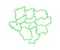
Grenzen
-
- Access constraints
- License
- Other constraints
-
Datenlizenz Deutschland -Namensnennung - Version 2.0
- Service Type
- OGC:WMS
- Service Version
-
1.3.0
- Fees
-
keine
))
Coupled Resource
- Operation Name
-
GetMap
- Identifier
-
90c4a6f6e3b96d9f96e613d5dd52162675d2fa7f
- Coupling Type
- Tight
Contains Operations
- Operation Name
-
GetCapabilities
- Distributed Computing Platforms
- HTTP-GET
- Connect Point
-
Format : text/xml
(
text/xml
)
Format :
text/xml
Contains Operations
- Operation Name
-
GetMap
- Distributed Computing Platforms
- HTTP-GET
- Connect Point
-
Format : image/jpeg
(
image/jpeg
)
Format :
image/jpeg
- Connect Point
-
Format : image/png
(
image/png
)
Format :
image/png
- Connect Point
-
Format : image/png; mode=16bit
(
image/png; mode=16bit
)
Format :
image/png; mode=16bit
- Connect Point
-
Format : image/png; mode=8bit
(
image/png; mode=8bit
)
Format :
image/png; mode=8bit
- Connect Point
-
Format : image/png; mode=1bit
(
image/png; mode=1bit
)
Format :
image/png; mode=1bit
- Connect Point
-
Format : application/dxf
(
application/dxf
)
Format :
application/dxf
Contains Operations
- Operation Name
-
GetFeatureInfo
- Distributed Computing Platforms
- HTTP-GET
- Connect Point
-
Format : text/plain
(
text/plain
)
Format :
text/plain
- Connect Point
-
Format : text/html
(
text/html
)
Format :
text/html
- Connect Point
-
Format : text/xml
(
text/xml
)
Format :
text/xml
- Connect Point
-
Format : application/vnd.ogc.gml
(
application/vnd.ogc.gml
)
Format :
application/vnd.ogc.gml
- Connect Point
-
Format : application/vnd.ogc.gml/3.1.1
(
application/vnd.ogc.gml/3.1.1
)
Format :
application/vnd.ogc.gml/3.1.1
Contains Operations
- Operation Name
-
sld:GetLegendGraphic
- Distributed Computing Platforms
- HTTP-GET
- Connect Point
-
Format : image/jpeg
(
image/jpeg
)
Format :
image/jpeg
- Connect Point
-
Format : image/png
(
image/png
)
Format :
image/png
Contains Operations
- Operation Name
-
sld:DescribeLayer
- Distributed Computing Platforms
- HTTP-GET
- Connect Point
-
Format : text/xml
(
text/xml
)
Format :
text/xml
Contains Operations
- Operation Name
-
qgs:GetStyles
- Distributed Computing Platforms
- HTTP-GET
- Connect Point
-
Format : text/xml
(
text/xml
)
Format :
text/xml
- Operates On
- Distribution format
-
-
WMS
(
1.3.0
)
-
WMS
(
1.3.0
)
- OnLine resource
- https://geoweb1.digistadtdo.de/OWSServiceProxy/stadtbezirke_abfragbar.ows?& ( OGC:WMS-http-get-map )
- Hierarchy level
- Service
Attributes
- Statement
-
Eigene Erfassung
- File identifier
- 3af599dca14410e69ee27445d100c76369001414 XML
- Metadata language
- Deutsch
- Character set
- UTF8
- Hierarchy level
- Service
- Hierarchy level name
-
WMS-Dienst
- Date stamp
- 2018-11-09T10:35:24
- Metadata standard name
-
ISO 19119/2005
- Metadata standard version
-
1.0
Overviews
Spatial extent
Provided by