Stadt Dortmund: WMS - Forschung
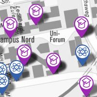
Informationen über Forschungseinrichtungen in Dortmund
Simple
Identification info
- Date (Revision)
- 2017-09-26T09:02:54
- Status
- On going
- Theme
-
-
infoMapAccessService
-
-
Anwendungen
-
-
map.apps
-
-
theme.govdata
-
-
Bildung und Wissenschaft
-
- Theme
-
-
Dortmund
-
- Access constraints
- License
- Other constraints
-
Datenlizenz Deutschland – Namensnennung – Version 2.0
- Service Type
- OGC:WMS
- Service Version
-
1.3.0
- Fees
-
keine
))
Coupled Resource
- Operation Name
-
GetMap
- Identifier
-
ba462c397fa4b2c25f677145e3b0e602eb55fed6
Coupled Resource
- Operation Name
-
GetMap
- Identifier
-
2b6388e70f45d7482beb15427c88265c4aeb01d6
Coupled Resource
- Operation Name
-
GetMap
- Identifier
-
bd300de7db9a1faafdc5dd92dc3a43e6d290b388
- Coupling Type
- Tight
Contains Operations
- Operation Name
-
GetCapabilities
- Distributed Computing Platforms
- HTTP-GET
- Connect Point
-
Format : text/xml
(
text/xml
)
Format :
text/xml
Contains Operations
- Operation Name
-
GetMap
- Distributed Computing Platforms
- HTTP-GET
- Connect Point
-
Format : image/jpeg
(
image/jpeg
)
Format :
image/jpeg
- Connect Point
-
Format : image/png
(
image/png
)
Format :
image/png
- Connect Point
-
Format : image/png; mode=16bit
(
image/png; mode=16bit
)
Format :
image/png; mode=16bit
- Connect Point
-
Format : image/png; mode=8bit
(
image/png; mode=8bit
)
Format :
image/png; mode=8bit
- Connect Point
-
Format : image/png; mode=1bit
(
image/png; mode=1bit
)
Format :
image/png; mode=1bit
- Connect Point
-
Format : application/dxf
(
application/dxf
)
Format :
application/dxf
Contains Operations
- Operation Name
-
GetFeatureInfo
- Distributed Computing Platforms
- HTTP-GET
- Connect Point
-
Format : text/plain
(
text/plain
)
Format :
text/plain
- Connect Point
-
Format : text/html
(
text/html
)
Format :
text/html
- Connect Point
-
Format : text/xml
(
text/xml
)
Format :
text/xml
- Connect Point
-
Format : application/vnd.ogc.gml
(
application/vnd.ogc.gml
)
Format :
application/vnd.ogc.gml
- Connect Point
-
Format : application/vnd.ogc.gml/3.1.1
(
application/vnd.ogc.gml/3.1.1
)
Format :
application/vnd.ogc.gml/3.1.1
Contains Operations
- Operation Name
-
sld:GetLegendGraphic
- Distributed Computing Platforms
- HTTP-GET
- Connect Point
-
Format : image/jpeg
(
image/jpeg
)
Format :
image/jpeg
- Connect Point
-
Format : image/png
(
image/png
)
Format :
image/png
Contains Operations
- Operation Name
-
sld:DescribeLayer
- Distributed Computing Platforms
- HTTP-GET
- Connect Point
-
Format : text/xml
(
text/xml
)
Format :
text/xml
Contains Operations
- Operation Name
-
qgs:GetStyles
- Distributed Computing Platforms
- HTTP-GET
- Connect Point
-
Format : text/xml
(
text/xml
)
Format :
text/xml
- Distribution format
-
-
WMS
(
1.3.0
)
-
WMS
(
1.3.0
)
- OnLine resource
- Forschung ( OGC:WMS-http-get-map )
- OnLine resource
- INFO_Forschung ( OGC:WMS-http-get-map )
- OnLine resource
- Hochschule ( OGC:WMS-http-get-map )
- OnLine resource
- Wissenschaftseinrichtung ( OGC:WMS-http-get-map )
- Hierarchy level
- Service
Attributes
- Statement
-
Erfassung durch das Vermessungs- und Katasteramt der Stadt Dortmund
- File identifier
- 3ba301931338035af7c6b4e5d38eecc0818ce95e XML
- Metadata language
- Deutsch
- Character set
- UTF8
- Hierarchy level
- Service
- Hierarchy level name
-
WMS
- Date stamp
- 2017-09-26T15:46:17
- Metadata standard name
-
ISO 19119/2005
- Metadata standard version
-
1.0
Overviews
Spatial extent
Provided by