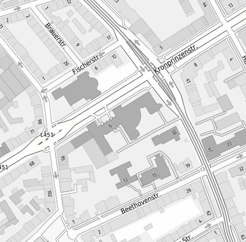
SPW2 GrauBlau
Stadtkarte 2.0 auf Basis von ALKIS-, ATKIS- und OSM-Daten
Simple
- Date (Creation)
- 2019-05-01
- Date (Revision)
- 2019-09-02
- Identifier
- https://registry.gdi-de.org/id/de.nw/9730819c-08ef-43b7-b25d-39221130c12a
- Status
- On going
- Theme
-
-
ALKIS
-
Nordrhein-Westfalen
-
Ruhrgebiet
-
Bergisches Land
-
Regionalverband Ruhr
-
RVR
-
Stadtplan
-
Karte
-
Stadtplanwerk
-
OSM
-
OpenStreetMap
-
opendata
-
REGI
-
TRAN
-
- Access constraints
- Other restrictions
- Other constraints
- Es gelten keine Zugriffsbeschränkungen
- Use limitation
-
Datengrundlagen: ALKIS, ATKIS - Land NRW/Katasterämter (Datenlizenz Deutschland - Zero - Version 2.0) und © OpenStreetMap - Mitwirkende (License: ODbL)
- Use constraints
- Other restrictions
- Other constraints
-
Datengrundlagen: ALKIS, ATKIS - Land NRW/Katasterämter (Datenlizenz Deutschland - Zero - Version 2.0) und © OpenStreetMap - Mitwirkende (License: ODbL)
- Other constraints
-
{"id": "dl-by-de/2.0", "name": "Datenlizenz Deutschland Namensnennung 2.0", "url": " http://www.govdata.de/dl-de/by-2-0 ", "quelle": "Quelle: © Regionalverband Ruhr und Kooperationspartner"}
- Spatial representation type
- Vector
- Metadata language
- Deutsch
- Topic category
-
- Society
- Location
))
- Unique resource identifier
- EPSG:25832
- Distribution format
-
-
XML
(
)
-
XML
(
)
- OnLine resource
- SPW2 GrauBlau
- File identifier
- 7c297748-9baa-48b4-92e2-a5679dac3bf0 XML
- Metadata language
- Deutsch
- Character set
- UTF8
- Hierarchy level
- Dataset
- Date stamp
- 2025-02-04
- Metadata standard name
-
ISO 19115:2003/19139
- Metadata standard version
-
1.0
Overviews

Spatial extent
))
Provided by
