Stadtplanwerk 2.0
Das Stadtplanwerk 2.0 in Zusammenarbeit mit dem RVR stellt den amtlichen Stadtplan Recklinghausen in unterschiedlichen Ausprägungen als Rasterbildpyramide dar.
Simple
- Date (Creation)
- Date (Revision)
- 2025-01-28
- Identifier
- https://registry.gdi-de.org/id/de.nw/5ecab116-d434-4875-bb76-4ddc91a5613d
- Status
- On going
- Theme
-
-
Stadtplan
-
Stadtplanwerk
-
Regionalverband Ruhr
-
Karte
-
opendata
-
REGI
-
- Access constraints
- Other restrictions
- Other constraints
- Es gelten keine Zugriffsbeschränkungen
- Use limitation
-
Open Database License, RVR eigene Lizenz
- Use constraints
- Other restrictions
- Other constraints
-
Open Database License, RVR eigene Lizenz
- Other constraints
-
{"id": "dl-zero-de/2.0", "name": "Datenlizenz Deutschland Zero 2.0", "url": " https://www.govdata.de/dl-de/zero-2-0"}
- Spatial representation type
- Vector
- Metadata language
- Deutsch
- Topic category
-
- Imagery base maps earth cover
N
S
E
W
))
- Unique resource identifier
- EPSG:25832
- Distribution format
-
-
TIFF
(
)
-
TIFF
(
)
- Name
-
Stadtplanwerk 2.0
- Description
-
Stadtplanwerk 2.0
- Function
- Download
- File identifier
- 9cddbc8a-aab1-43ae-9849-7412dc2a5fc3 XML
- Metadata language
- Deutsch
- Character set
- UTF8
- Hierarchy level
- Dataset
- Date stamp
- 2025-04-15
- Metadata standard name
-
ISO 19115:2003/19139
- Metadata standard version
-
1.0
Overviews
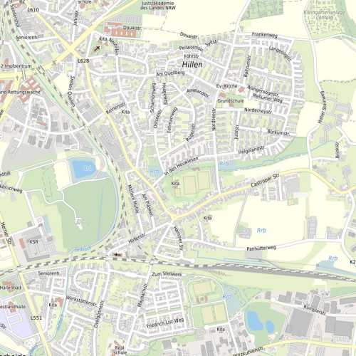
thumbnail
Spatial extent
N
S
E
W
Provided by
Associated resources
Not available