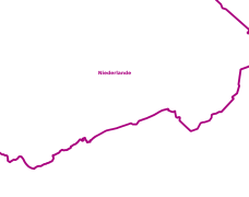
Stadtplanwerk Web - Staatsgrenze
Der Layer enthält die Staatsgrenze für die Dienste des Stadtplanwerks
Simple
- Date (Creation)
- 2019-08-01
- Date (Revision)
- 2019-11-29
- Identifier
- https://registry.gdi-de.org/id/de.nw/6a169ff4-1dca-4838-bf21-ea0bc6e88c4a
- Theme
-
-
opendata
-
- Access constraints
- Other restrictions
- Use limitation
-
Nutzungsbedingungen: Creative Commons Namensnennung 4.0 International
- Use constraints
- Other restrictions
- Other constraints
-
Nutzungsbedingungen: Creative Commons Namensnennung 4.0 International
- Other constraints
-
{"id":"cc-by/4.0", "name": "Creative Commons Namensnennung 4.0 International", "url": " https://creativecommons.org/licenses/by/4.0/deed.de ", "quelle": "Quelle: © Regionalverband Ruhr"}
- Metadata language
-
ger
- Topic category
-
- Society
- Location
- Transportation
))
- Unique resource identifier
- EPSG:25832
- OnLine resource
-
staatsgrenze
(
OGC:WMS
)
Stadtplanwerk Web - Staatsgrenze
- OnLine resource
- Stadtplanwerk Web - Staatsgrenze ( WWW:LINK-1.0-http--link )
- Hierarchy level
- Dataset
- Statement
-
eigene Erfassung des Regionalverband Ruhr mit Kommunen des Stadtplanwerk
- File identifier
- a77b6814-28fe-42a3-9ce1-deaaf2cc8a7d XML
- Metadata language
- Deutsch
- Character set
- UTF8
- Hierarchy level
- Dataset
- Date stamp
- 2025-11-18
- Metadata standard name
-
ISO 19115:2003/19139
- Metadata standard version
-
1.0
Overviews
Spatial extent
Provided by
