WMS Digitale Orthophotos RVR
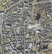
Digitale Orthophotos (DOP) des RVR - WMS-Dienst für farbige, digitale, georeferenzierte, lagegenaue, entzerrte Luftbilder des Regionalverband Ruhr (Verbandsgebiet). Der Dienst stellt Orthophotos für die Jahre 2006 bis 2025 bereit. In der Standardeinstellung wird immer das aktuellste Orthophoto für eine Gebietskörperschaft angezeigt. Ältere Zeitstände sind durch Benutzung des WMS-Time-Parameters verfügbar.
Simple
Identification info
- Date (Creation)
- 2019-08-01
- Date (Revision)
- 2026-05-02
- Theme
-
-
infoMapAccessService
-
DOP
-
DOP10
-
DOP20
-
Digitale Orthophotos
-
Orthophotos
-
Luftbilder
-
2006
-
2007
-
2008
-
2009
-
2010
-
2011
-
2012
-
2013
-
2014
-
2015
-
2016
-
2017
-
2018
-
2019
-
2020
-
2021
-
2022
-
2023
-
2024
-
2025
-
Geobasisdaten
-
RVR
-
Regionalverband Ruhr
-
NRW
-
Nordrhein-Westfalen
-
Ruhrgebiet
-
Planung
-
Umwelt
-
Verkehr
-
Freiraumentwicklung
-
Wirtschaft
-
Luftbildinterpretation
-
Dokumentation
-
infoMapAccessService
-
opendata
-
- Access constraints
- Other restrictions
- Use constraints
- Other restrictions
- Other constraints
-
{"id":"dl-by-de/2.0", "name": "Datenlizenz Deutschland Namensnennung 2.0", "url": " http://www.govdata.de/dl-de/by-2-0 ", "quelle": "Quelle: © Regionalverband Ruhr"}
- Other constraints
-
Nutzungsbedingungen:
- Service Type
- view
- Service Version
-
OGC:WMS 1.3.0
- Fees
-
no conditions apply
- Coupling Type
- Tight
Contains Operations
- Operation Name
-
GetCapabilities
- Distributed Computing Platforms
- Web services
- Connect Point
- https://geodaten.metropoleruhr.de/dop/dop?
- OnLine resource
- WMS Digitale Orthophotos RVR ( application/vnd.ogc.wms_xml )
- File identifier
- c88b0f40-8139-4b1b-accd-fa66a42e4012 XML
- Metadata language
- Deutsch
- Character set
- UTF8
- Hierarchy level
- Service
- Hierarchy level name
-
Service
- Date stamp
- 2026-07-01
- Metadata standard name
-
ISO 19119/2005
- Metadata standard version
-
1.0
Overviews
Spatial extent
Provided by
