Stadt Dortmund: WMS - Bahnhaltestelle
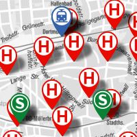
Informationen zu Bahnhaltestellen in Dortmund
Simple
Identification info
- Date (Revision)
- 2017-10-23T14:02:46
- Status
- On going
- Theme
-
-
infoMapAccessService
-
-
Anwendungen
-
-
map.apps
-
-
theme.govdata
-
-
Infrastruktur, Bauen und Wohnen
-
Transport und Verkehr
-
- Theme
-
-
Dortmund
-
- Access constraints
- License
- Other constraints
-
Datenlizenz Deutschland – Namensnennung – Version 2.0
- Service Type
- OGC:WMS
- Service Version
-
1.3.0
- Fees
-
keine
))
Coupled Resource
- Operation Name
-
GetMap
- Identifier
-
24314d92606145f462d9c4689bc3605f35934071
Coupled Resource
- Operation Name
-
GetMap
- Identifier
-
7612ddf922afe5b1120e6f4515b0c9245d8e063c
Coupled Resource
- Operation Name
-
GetMap
- Identifier
-
93c7ca5c7cb9be0b3c654a9ccc74fd6847865c1d
Coupled Resource
- Operation Name
-
GetMap
- Identifier
-
47076f43d796f3748dbabfafc7c6ec0eb4f38aaf
Coupled Resource
- Operation Name
-
GetMap
- Identifier
-
14a108b9d74e29bf85fc60ac340b6123a466cd4c
- Coupling Type
- Tight
Contains Operations
- Operation Name
-
GetCapabilities
- Distributed Computing Platforms
- HTTP-GET
- Connect Point
-
Format : text/xml
(
text/xml
)
Format :
text/xml
Contains Operations
- Operation Name
-
GetMap
- Distributed Computing Platforms
- HTTP-GET
- Connect Point
-
Format : image/jpeg
(
image/jpeg
)
Format :
image/jpeg
- Connect Point
-
Format : image/png
(
image/png
)
Format :
image/png
- Connect Point
-
Format : image/png; mode=16bit
(
image/png; mode=16bit
)
Format :
image/png; mode=16bit
- Connect Point
-
Format : image/png; mode=8bit
(
image/png; mode=8bit
)
Format :
image/png; mode=8bit
- Connect Point
-
Format : image/png; mode=1bit
(
image/png; mode=1bit
)
Format :
image/png; mode=1bit
- Connect Point
-
Format : application/dxf
(
application/dxf
)
Format :
application/dxf
Contains Operations
- Operation Name
-
GetFeatureInfo
- Distributed Computing Platforms
- HTTP-GET
- Connect Point
-
Format : text/plain
(
text/plain
)
Format :
text/plain
- Connect Point
-
Format : text/html
(
text/html
)
Format :
text/html
- Connect Point
-
Format : text/xml
(
text/xml
)
Format :
text/xml
- Connect Point
-
Format : application/vnd.ogc.gml
(
application/vnd.ogc.gml
)
Format :
application/vnd.ogc.gml
- Connect Point
-
Format : application/vnd.ogc.gml/3.1.1
(
application/vnd.ogc.gml/3.1.1
)
Format :
application/vnd.ogc.gml/3.1.1
Contains Operations
- Operation Name
-
sld:GetLegendGraphic
- Distributed Computing Platforms
- HTTP-GET
- Connect Point
-
Format : image/jpeg
(
image/jpeg
)
Format :
image/jpeg
- Connect Point
-
Format : image/png
(
image/png
)
Format :
image/png
Contains Operations
- Operation Name
-
sld:DescribeLayer
- Distributed Computing Platforms
- HTTP-GET
- Connect Point
-
Format : text/xml
(
text/xml
)
Format :
text/xml
Contains Operations
- Operation Name
-
qgs:GetStyles
- Distributed Computing Platforms
- HTTP-GET
- Connect Point
-
Format : text/xml
(
text/xml
)
Format :
text/xml
- Distribution format
-
-
WMS
(
1.3.0
)
-
WMS
(
1.3.0
)
- OnLine resource
- Bahnhaltestelle ( OGC:WMS-http-get-map )
- OnLine resource
- INFO_Haltestelle_Bahn ( OGC:WMS-http-get-map )
- OnLine resource
- H_Bahn ( OGC:WMS-http-get-map )
- OnLine resource
- Regionalbahn ( OGC:WMS-http-get-map )
- OnLine resource
- S_Bahn ( OGC:WMS-http-get-map )
- OnLine resource
- Stadtbahn ( OGC:WMS-http-get-map )
- Hierarchy level
- Service
Attributes
- Statement
-
Erfassung durch das Vermessungs- und Katasteramt
- File identifier
- dcb3c34e6e49c0a2b08a7517d957463563315c6b XML
- Metadata language
- Deutsch
- Character set
- UTF8
- Hierarchy level
- Service
- Hierarchy level name
-
WMS-Dienst
- Date stamp
- 2017-10-23T16:17:21
- Metadata standard name
-
ISO 19119/2005
- Metadata standard version
-
1.0
Overviews
Spatial extent
Provided by