WMS Digitale Orthophotos RVR 2016
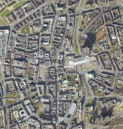
Digitale Orthophotos (DOP) des RVR für das Jahr 2016 - WMS-Dienst für farbige, digitale, georeferenzierte, lagegenaue, entzerrte Luftbilder des Regionalverband Ruhr (Verbandsgebiet)
Simple
Identification info
- Date (Creation)
 - 2019-08-01
 
- Date (Revision)
 - 2019-08-02
 
- Theme
 - 
                                
- 


infoMapAccessService
 - 


DOP
 - 


DOP10
 - 


DOP20
 - 


Digitale Orthophotos
 - 


Orthophotos
 - 


Luftbilder
 - 


2016
 - 


Geobasisdaten
 - 


RVR
 - 


Regionalverband Ruhr
 - 


NRW
 - 


Nordrhein-Westfalen
 - 


Ruhrgebiet
 - 


Planung
 - 


Umwelt
 - 


Verkehr
 - 


Freiraumentwicklung
 - 


Wirtschaft
 - 


Luftbildinterpretation
 - 


Dokumentation
 - 


opendata
 
 - 


- Access constraints
 - Other restrictions
 
- Use constraints
 - Other restrictions
 
- Other constraints
 - 


{"id":"dl-by-de/2.0", "name": "Datenlizenz Deutschland Namensnennung 2.0", "url": " http://www.govdata.de/dl-de/by-2-0 ", "quelle": "Quelle: © Regionalverband Ruhr"}
 
- Other constraints
 - 


Nutzungsbedingungen:
 
- Service Type
 - view
 
- Service Version
 - 


OGC:WMS 1.3.0
 
- Fees
 - 


no conditions apply
 
                            - Coupling Type
 - Tight
 
Contains Operations
- Operation Name
 - 


GetCapabilities
 
- Distributed Computing Platforms
 - Web services
 
- Connect Point
 - https://geodaten.metropoleruhr.de/dop/dop_2016?
 
- Unique resource identifier
 - EPSG:25832
 
- Unique resource identifier
 - EPSG:25833
 
- Unique resource identifier
 - EPSG:3857
 
- Unique resource identifier
 - EPSG:4258
 
- Unique resource identifier
 - EPSG:4326
 
- Unique resource identifier
 - EPSG:31466
 
- Unique resource identifier
 - EPSG:31467
 
- Unique resource identifier
 - EPSG:31468
 
- Unique resource identifier
 - EPSG:31469
 
- Unique resource identifier
 - EPSG:900913
 
- Unique resource identifier
 - EPSG:4647
 
- OnLine resource
 - WMS Digitale Orthophotos RVR 2016 ( application/vnd.ogc.wms_xml )
 
- File identifier
 - e3d4bb1e-22a7-4546-babd-ddfbc9786585 XML
 
- Metadata language
 - Deutsch
 
- Character set
 - UTF8
 
- Hierarchy level
 - Service
 
- Hierarchy level name
 - 


Service
 
- Date stamp
 - 2025-10-21
 
- Metadata standard name
 - 


ISO 19119/2005
 
- Metadata standard version
 - 


1.0
 
Overviews
                  Spatial extent
                  Provided by